Download Center

Hydropower Potential Analysis Reports
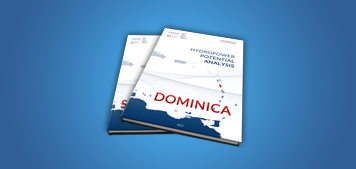
On behalf of CREDP-GIZ, geoMinds assessed the technical and economically viable hydropower potential of the eastern caribbean islands of Dominica and Saint Luci applying the hydroMinds-Tool. The final reports of the analysis are available for download here.

Free GIS-data for the Caribbean Region
geoMinds offers OpenStreetMap (OSM) data converted in shapefile format and referenced in geographic coordinates (D-WGS 1984; EPSG 4326). The license-free geodata of OSM is updated frequently and datasets are available even for smaller countries. All available data is licensed under the Open Database License 1.0 and may be used for any purpose, but data source should be referred to as OpenStreetMap.
Each [selected data]-file contains extracted OpenStreetMap-data of the respective country provided as single shapefiles:
roads.shp
buildings.shp
waterways.shp
cities.shp
coastline.shp
annotations.shp
Provided GIS-datasets are licensed under: Open Database License (ODbL) v1.0
Provided GIS-datasets are licensed under: Open Database License (ODbL) v1.0


 Anguilla (U.K.) (~1 MB; rar)
 Antigua and Barbuda (~4 MB; rar)
 British Virgin Islands (U.K.) (~1 MB; rar)
 Dominica (~4 MB; rar)
 Guadeloupe (FR.) (~30 MB; rar)
 Montserrat (U.K.) (< 1 MB; rar)
 Saba (ND.) (< 1 MB; rar)
 Saint Kitts and Nevis (~2 MB; rar)
 Saint Martin (ND./FR.) (~8 MB; rar)
 Sint Eustatius (ND.) (< 1 MB; rar)
 United States Virgin Islands (U.S.) (~5 MB; rar)
 Barbados (~9 MB; rar)
 Grenada (~4 MB; rar)
 Saint Lucia (~4 MB; rar)
 Saint Vincent and the Grenadines (~3 MB; rar)
 Trinidad and Tobago (~21 MB; rar)
 Aruba (ND.) (~1 MB; rar)
 Bonaire (ND.) (< 1 MB; rar)
 Curaçao (ND.) (~1 MB; rar)
 Isla Margarita (VE.) (< 1 MB; rar)
 Cayman Islands (U.K.) (~2 MB; rar)
 Cuba (~66 MB; rar)
 Dominican Republic (~33 MB; rar)
 Haiti (~86 MB; rar)
 Jamaica (~68 MB; rar)
 Puerto Rico (U.S.) (~14 MB; rar)
 The Bahamas (~2 MB; rar)
 Turks and Caicos Islands (U.K.) (~1 MB; rar)
 Archipelago of San Andrés, Providencia and Santa Catalina (CO.) (~1 MB; rar)
 Bay Islands Department (HO.) (~1 MB; rar)
 Cozumel (MX.) (~1 MB; rar)
 Belize (~2 MB; rar)
 Costa Rica (~8 MB; rar)
 El Salavdor (~4 MB; rar)
 Guatemala (~7 MB; rar)
 Nicaragua (~2 MB; rar)
 Panama (~6 MB; rar)
 Guyana (~2 MB; rar)
 Suriname (~2 MB; rar)